
The mountain torrent disaster monitoring and early warning system solution mainly solves the actual needs of torrent disaster prevention and the convenience of information query. Combining modern information processing technology, network technology and GIS technology, the mountain torrent disaster early warning system provides the inquiry, retrieval, analysis and comparison of water and rainfall information, basic meteorological data, engineering operation information and disaster conditions in the database, so as to provide basis for the torrent early disaster warning by provincial, municipal or county-level flood disaster prevention and command departments. In addition, according to the criticality of the early warning information and the range of possible damage from torrents, through appropriate early warning procedures and methods, the early warning information is timely and accurately transmitted to the area where the torrent may endanger, so that the personnel in the area receiving early warning can take precautionary measures in time according to the torrent disaster prevention plan to minimize casualties.
The Reservoir Hydrological Forecast and Dam Safety Monitoring System are designed to meet the requirements of reservoir safety, flood control and water resources dispatch. The construction of automatic reservoir hydrological forecasting and dam safety monitoring system to realize the automatic monitoring and network transmission of dam conditions and hydrological data is the requirement of national policy of "National Water Conservancy Informatization" by the Ministry of Water Resources. It also meets the actual needs of reservoirs and is an effective preventive measure to avoid accidents such as landslides and dam cracks.
Relying on the established water conservancy information facilities, the Water Resource Dispatching System is established based on water resource management data. The system includes two parts: water resource dispatching model and management subsystem. The water resources dispatch model provides functions such as incoming water forecasting, water demand forecasting, river evolution, water distribution and gate dispatching simulation. The management subsystem mainly provides water dispatching plans. It can simulate and demonstrate the functions of scheduling plan management, plan implementation evaluation and parameter optimization. This system provides a basis for formulating scientific and reasonable water resources dispatching plans and dynamic management of water resources.
With the development of geospatial information technology with 3S as the main body, the earth observation from space system with remote sensing technology as an important content provides brand new technical means for resource and environmental monitoring, evaluation and management. Through remote sensing monitoring combined with fixed-point ground observations, water resources and water environment of the entire basin are dynamically monitored and analyzed. The development of a basin water environment consultation decision support system can provide relevant government departments in China with theoretical bases, key technologies and information platform support in terms of water resources environmental quality evaluation and prevention, disaster warning and disaster emergency.
The system adopts mature J2EE or .NET technical framework and realizes real-time monitoring of underground water monitoring information (water level, water temperature, etc.) through wired and wireless channels and can return the calculation results to remote customers. The system mainly consists of information collection and transmission layer, communication and network layer, data resource layer, application support layer, business application layer and portal layer. It can support both B/S and C/S architectures and combines GIS and other technologies to realize underground water information query and maintenance, underground water dynamic analysis and prediction, resource evaluation and underground water information release.
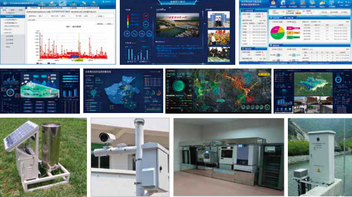
Software products:Mountain torrent disaster predication water resources real-time monitoring and management platform water resources fee collection management system small and medium river hydrological monitoring and forecasting system engineering information acquisition system SMS notification platform system
Hardware products:Intelligent radar water level meter radar velocity meter underground water integrated monitoring station simple rainfall announcer wireless early warning broadcast integrated automatic precipitation station intelligent hydrological and water resources measurement and control terminal
Platform category:Smart water platforms at district and county levels

Mobile site
版权所有 © 北京奥特美克科技股份有限公司 京ICP备 12046416号 京公网安备 11010802027038号